Search This Blog

Showing posts with label Water Tank. Show all posts

Lohgad Fort

Sunday, October 9, 2011


Lohagad, literally Iron Fort, is situated in Malavali, near Lonavala, on the Mumbai Pune rail line. It is 3,450 feet above sea level. In its glory days, Lohagad was ruled by various dynasties. The last ruler was Chhatrapati Shivaji.

Two of my office colleagues, Nimish and Darshan, accompanied me on my trek to Lohagad, Visapur Fort and Bhaje Caves.


Lohgad Fort
This fort can be visited both by rail and road transport. It takes around 4 hours to reach the fort if you travelling by train from Mumbai. We boarded the Chennai Mail train from Karjat station. As ill luck would have it, it turned out that the train did not halt at Malavali. We had to get down at Lonavala. We were told that the Pandharpur Express would halt at Malavali. We raced to catch this train at Karjat station but missed it by a couple of seconds. We had plenty of time to regret this missed train as we ended up spending 3 hours at Lonavala station.

I began to feel so sleepy that I spent the night on Lonavala station sleeping on one of the benches made for commuters to sit. I have never done this on any of my treks. My colleagues stayed awake all night, guarding our bags.
Lohgad Fort from a distance
We boarded the first local to Pune at around and reached Malavali station in 15 minutes. All that wait for such a short journey! After that we decided to walk to the fort. It took us around 2½ hrs to reach Lohagaon, the base village of the fort. Lohagaon can also be reached by road from Lonavala.

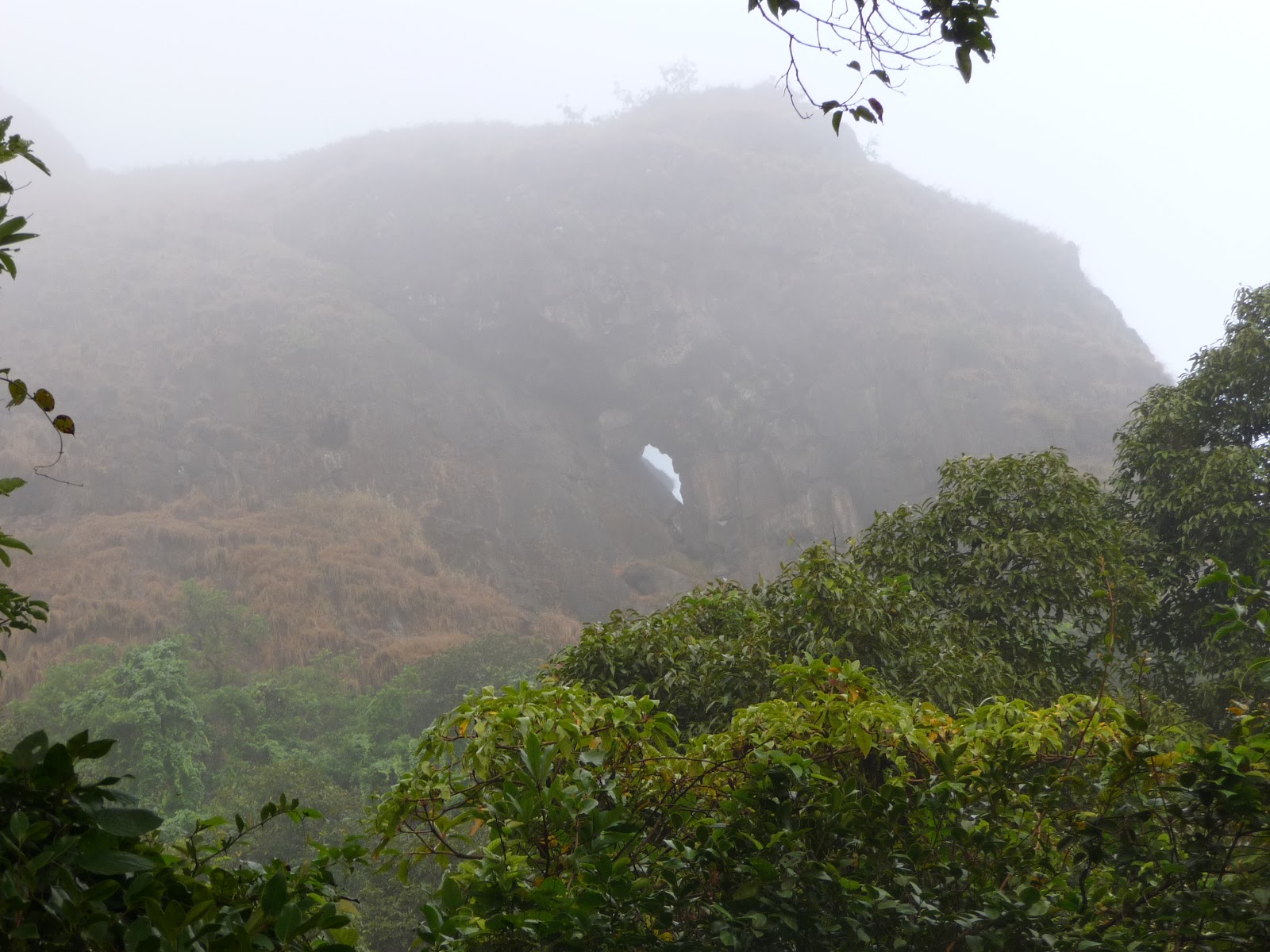
At this hour in the morning, there were no other trekkers in sight, just the 3 of us. The roads were rather muddy. The fog was so thick and dense that we couldn't see even a few metres ahead of us. It was rather risky but we managed to go ahead.

On the way we met a few school children running hastly downhill, hoping that they would not be late for school. We made small talk with the children and they told us that there was no school in Lohagaon and that the nearest school was in Bhaje, a neighbouring village where the Bhaje Caves are located. It was sad that the children had to trek for 2 hours daily to go to school, but the good thing was that the children were going to school in spite of the difficulties.


Foggy way up to the base of Lohgad Fort
It was still foggy when we climbed the steps to the fort. It was beautiful to see the scenic view around as we were climbing up. To reach the top we had to enter through 4 doors called Darwajas in Marathi. Only one of the Darwajas had doors made of wood painted black with iron nails and chains bound on it.

We finally reached the top. The view was amazing. We could see Visapur Fort in the distance, a few hill ranges far away in the village below, the road which takes one to Lonavala station, Pawna Dam and a few lakes in the vicinity.


Stairway to Lohgad Fort
From the top just above the last Darwaja, we could see the path by which we had climbed. Atop the fort we saw a temple, a dargah (prayer house for Muslims), a few water tanks, caves and a burial site for Muslims.

There is an extension to this fort called the Vinchu Kata or Scorpions Tail in English. The name is derived from the shape of the place, which is like the tail of a scorpion. I had been to Lohagad twice before but had never visited Vinchu Kata. This time I had made up my mind that I would visit this place come what may. As the weather was foggy and the ground was wet, we encountered a fair bit of trouble in our attempt to reach Vinchu Kata.


Door (Darwaja) entrance to the Fort
It took us around an hour to reach the top. Thrilled with our achievement and tired with the exertion, we sat there for some time to enjoy the panoramic view and then decided to head down as we had Visapur Fort and Bhaje Caves on our agenda for the day. From here we could see the railway tracks going to Pune and the Mumbai Pune Expressway in the distance.


After viewing the entire fort, we finally decided to head for Lohagaon, where we had our lunch.


View from top
 The locals at Lohagaon have converted their homes into motels which provide both food and shelter to all the people who come to visit the fort. We had the local delicacy, zunka bhakar. Zunka is a gravy dish, green in colour, and bhakar is a roti made of jowar. It was very delicious. We had zunka bhakar and poha along with lime juice for lunch.
Vinchu Kata, extension to Lohgad Fort
Some of the locals advised us on the best way to reach Visapur fort. They told us that it was advisable to take someone from the village with us as we might get lost on the way. As it was already , we decided not to go to Visapur. It would take us at least 7 hours to ascend, view and descend from the fort. Visapur is much bigger than Lohagad fort.

We decided to head back to Bhaje Caves on the way to Malavali station. On the way we sat on the banks of a small stream with our feet in the water. We badly needed this rest and felt most relaxed as we had to head to Bhaje Caves and then home. From Malavali station or Lonavala there are many trains which take us to Mumbai.

Shirgaon Fort

Thursday, September 29, 2011


Shirgaon Fort is also located at a distance of 13 km from Palghar. It can be easily reached from Kelva, but as we had opted for public transport instead of private transport we had to go to Palghar and board a State transport (ST) bus to Satpati. It took us 30 minutes by ST bus to reach Shirgaon Fort.

The frequency of public transport is not good if you are travelling directly from Kelve beach to Shirgaon Fort. From Palghar station there are plenty of ST buses and tum tums to take you to Shirgaon Fort.


Shirgaon Fort
Shirgaon fort is well fortified and the walls are good condition. It took us an hour to see the fort. There are two towers located at the entrance of the fort from where one can geta a panaromic view of the place. The fort is small; it has a few rooms in it but they have not been well-maintained. There are many hidden caves in the walls of the fort. One cave leads to another.

Not much is known about who built this fort. However, at various points in history, the Portuguese, Marathas and the British had conquered the fort and ruled over it.


Inside the Fort
 As we entered the fort from the main entrance, we saw a unique palm tree with six to seven branches popping out. It was not something we had ever seen before.

Two steep staircases take one to the walls of the fort. The entire fort can be seen by walking on the walls. There is a water tank which looks as if it was recently constructed.


Fortification of Shirgaon Fort
Shiragon is a coastal fort and provides a very good view of the sea around. I have clicked a few photographs of horses grazing in lush green meadows with streams of water around. It was truly beautiful.

After exploring the fort in its entirety, we decided to take leave of the fort as we wanted to see Tarapur Fort.

Cabo De Rama Fort

Monday, October 18, 2010

I always make it a point to visit Goa during my summer holidays. On one such trip, I decided to go see the Cabo De Rama Fort also known as Cape Rama Fort. located in Cancona taluka in South Goa.

View from the top

The Cabo de Rama fort is currently in ruins. The name Cabo de Rama is Portuguese for the head of Rama. According to ancient Indian mythology, Prince Rama, from the epic Ramayana, along with his wife Sita took refuge here during Rama's exile from Ayodhya.
Fortification of Cabo de Rama Fort

Nobody knows who built this fort. At some point in the 17th century, however, the Portuguese took it over from the Raja of Soonda.
Steps leading to the wate body or pond

My cousin Sholto and I decided to visit the fort. We took the National Highway-17 to reach Cancona where the fort is located. One has to have a vehicle if one wants to visit the fort. Those who don’t have their own vehicle can choose to hire one. There are some public buses plying from Margao to the fort but the frequency of these buses is pathetic, and it is better to not rely on them.
Entrance to Cabo de Rama Fort

There is a rampart to enter the fort. In the old days, if a visitor was expected to the fort, the rampart would have to be lowered to enable the visitor to enter the fort. As the fort is on an island, the only entrance is through the rampart. Sounds really cool, doesn't it? I had seen such ramparts in the movies of the yesteryears but never in reality. How I wish I was born in that era! Currently the mechanism for operating the rampart is not functional. It is therefore always kept lowered down to enable public access.
Coconut trees all around

After entering the fort via the rampart, we decided to survey the ruined fort. The fort has got a few cannons that are worth checking out. The Church of Santo Antonio, located within the fort, is in excellent condition. Masses are offered here regularly.
St. Anthony Chapel in the fort premises

While the fort is in ruins, the western end of the fort has steep cliffs which provide a panoramic view of the place. From the western end, one can sight plenty of coconut trees which cover the land extremely densely, making it difficult for us to see the shore. It took us around two hours to view the fort.
View from the fort

We walked on the wall of the fort to see the view from every angle. The view I liked best was the one available from the sea side. Later, we had some refreshments before calling it a day.

Arnala Fort

Tuesday, October 5, 2010

Arnala Fort is built on an small island which can be accessed by a ferry from Arnala village. Arnala Village is located 10 KM away from Virar Railway station and around 14 KM away from Vasai Railway station on Western line. St. Peter's Church is also located here.
Old lighthouse near Arnal Fort


I saw the photos of Arnala fort on the Internet. The fort was in good condition, so I decided to pay a visit to it. This fort is also known as Jaldurg (literally sea-fort in Hindi) or Jangire- Arnala. This fort was built by a local chieftain from Gujarat and later owned by the Portuguese colonials.
St Peter's Church at Arnala Village

I asked my friend Hitesh to accompany me, I met Hitesh when I was in the 10th grade. Since both of us like trekking I asked him to join me in exploring the fort, and he agreed. So we decided that we would go to see the fort on a Saturday.
Lighthouse and Arnala Fort in a distance

Come Saturday morning, we boarded a fast train to Virar from Andheri Station on platform 4, alighted at Virar and boarded the ST bus to Arnala Village. Share and private rickshaw's also ply to the fort.It took us 35 minutes to reach the village. Alternatively Arnala Village can also be reached by ST bus from Vasai ST bus stand located outside Vasai railway station. No share rickshaw's are available from Vasai station.


Bastion at Arnala Fort

Arnala Market was the last stop for the bus and that is where we alighted. The market was packed with people. Smell of fish lingered all around. There was a Church nearby. St. Peter's Church. We entered the church, sat inside silently for some time and then headed out to see the fort.


Entrance to Arnala Fort


Fortification of Arnala Fort
We had to walk through narrow gullies surrounded by the houses of the local fisher folk on our way to the ferry wharf. Arnala fort, being a sea-fort, is in the middle of the water. This fact was not known to us earlier and it took us by surprise to know that we would need to go through waist-deep water to board the ferry. Our trousers were going to be wet. But we had not come all this way just to be put off by the fear of getting wet. As a lot of people stay on the island, the ferry was packed with more people than it could carry. But it was just the two of us who made it to the fort. Clearly the fort is not a must-see item on the agenda of tourists.


Fortification of Arnala Fort

Finally after 20 minutes, we reached the entrance of the fort. The fort was in very good condition. It has a hexagonal shaped water reservoir, temples and tombs. The main door of the fort is carved. It has a few bastions on it. It took us around 2 hours to see the entire fort along with photo shoots, of course.
Light House at a distance from Arnala Fort
Water tank at Arnala Fort
There is a lighthouse nearby which is around an hour’s distance from the fort. Unfortunately, there is no proper entrance to it. So we had to satisfy ourselves with looking at it from the outside.
Temple within Arnala Fort
Arnala Beach from Arnala Fort
The trek had tired us out considerably. Finally at the end of the day, we boarded the ferry and headed back to Arnala village and from there headed home.

Other sea forts I have visited are Murud Janjira, Alibag Fort and (Khanderi and Undheri )Forts in Alibag and Sindhudurg in Malvan

Popular Posts

Related Posts Plugin for WordPress, Blogger...